
FROM ROMAN PHILADELPHIA TO A CAPITAL OF LIMESTONE HOUSES ACROSS THE JABALS

Amman, capital of Jordan, is known as the city of seven hills. Each hill is a jabal, and most of the older neighbourhoods take their names from the hill they stand on: Jabal Amman, Jabal al-Lweibdeh, Jabal al-Hussein, Jabal al-Ashrafiyyeh and Jabal al-Qal'a, the Citadel hill. It was Rabbath Ammon, capital of the Ammonites, then Philadelphia, a Roman city of the Decapolis, and later an Umayyad governor's seat. Abandoned by the 14th century, it was resettled in 1878, when Circassian refugees from the North Caucasus built a village among the Roman ruins. It became the capital of the Emirate of Transjordan in 1921 and is now the country's largest city.
WHERE IS AMMAN AND WHY IS IT BUILT ON HILLS?
Amman stands on rolling hills at the eastern edge of the Ajlun Mountains, along the small, partly perennial Wadi Amman and its tributaries, according to Britannica. Encyclopedia entries on the modern city describe the original town as built on precipitous hills, the jabals, with the land opening out into gentler, rolling plains further from the centre. The highest point is the Citadel hill, Jabal al-Qal'a, at 837 metres, and it was here that every ancient phase of the city kept its main buildings.
Between the hills ran a seasonal stream, known locally as the sayl. Historian Vladimir Hamed-Troyansky records that by the 1950s the stream resembled an open sewer and had been encased in a culvert and buried underground. Its course is still marked in the street plan: the downtown street Saqf al-Sayl takes its name, meaning "ceiling of the stream", from the buried watercourse. Plaster statues found at 'Ain Ghazal, a Neolithic site now inside the city, date to around 6000 BC, long before any town stood on the hills.
RABBATH AMMON AND PHILADELPHIA: THE ANCIENT CITY ON THE CITADEL HILL

Jordan's Department of Antiquities records continuous settlement on Jabal al-Qal'a from the Bronze Age through the late Islamic periods. In the Iron Age the Ammonites made the hill their capital and named it Rabbath Ammon, the name by which the city appears in the Hebrew Bible. In the Hellenistic period Ptolemy II Philadelphus, the Macedonian king of Egypt, rebuilt the city and renamed it Philadelphia after himself. Under Rome, Philadelphia became one of the cities of the Decapolis, a group of ten cities in the area east of the Jordan River.
The Romans placed their main temple on the Citadel. The Temple of Hercules, dated by the Umayyad Route heritage project to between AD 62 and 166, rises prominently on the summit. In the Byzantine period three churches were built on the hill, including a small church of the 5th to 6th centuries. The summit is now an open-air archaeological site. The Jordan Archaeological Museum was built there in 1951 and holds finds from across Jordan, including the 'Ain Ghazal statues and the Dead Sea bronze scroll written in Aramaic characters.
THE ROMAN THEATRE AND THE CITY BELOW THE CITADEL
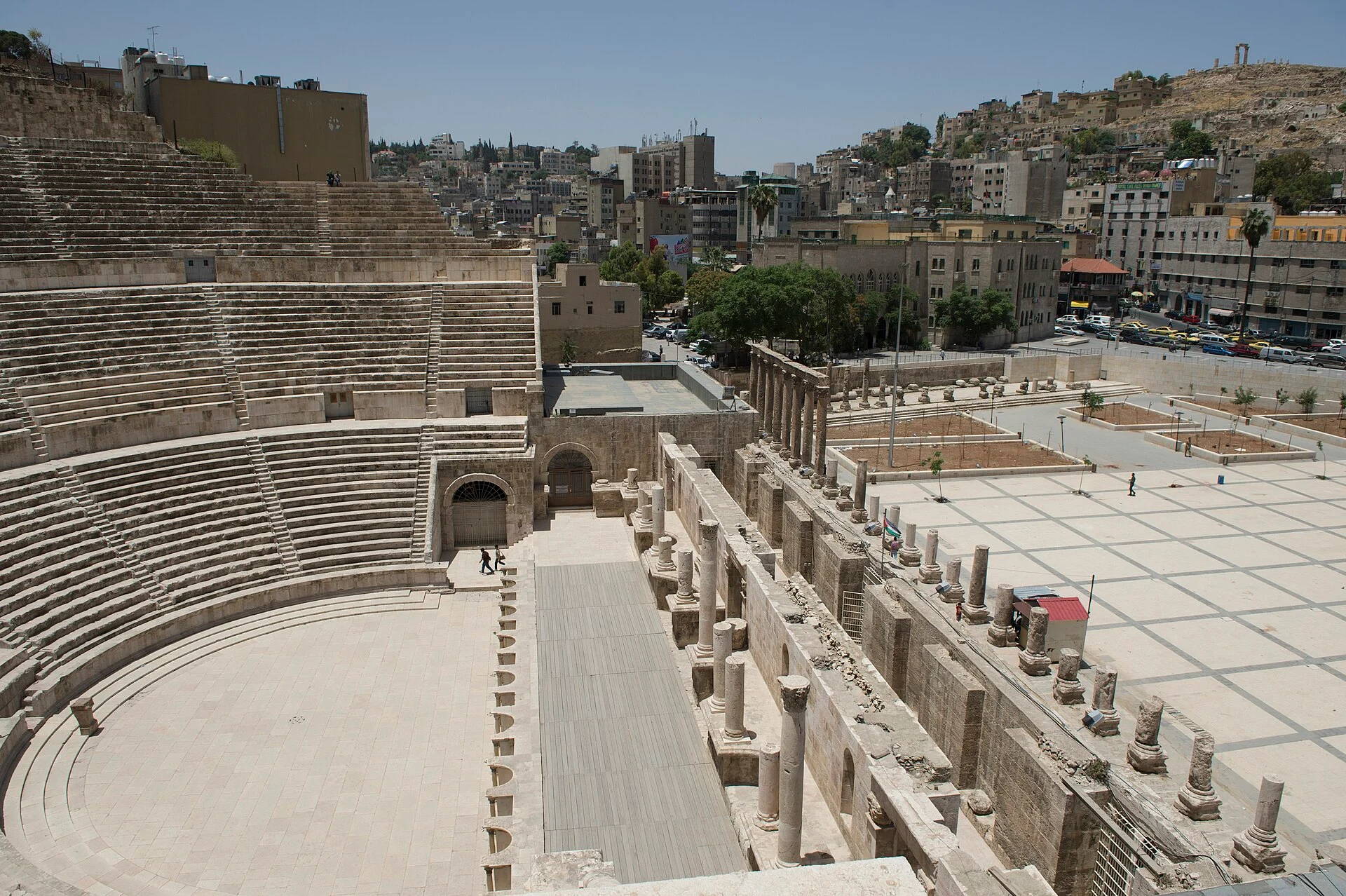
Roman Philadelphia also spread across the valley floor below the Citadel. Its largest surviving building is the Roman Theatre, or Grand Theatre, cut into a hillside below the Citadel. An inscription dates it to the 2nd century AD, in the reign of the emperor Antoninus Pius. It held about 6,000 spectators in three tiers of seating. Senators sat in the lowest tier, citizens in the middle and the poor, foreigners, slaves and women at the top. The Department of Antiquities began restoring the theatre in 1957, and it is still used for performances.
Beside the theatre, on the edge of the Roman forum, stands the Odeon, a smaller theatre for about 400 spectators, begun in AD 130 and completed around AD 141. Its lower seating was restored in 1986. About 600 metres west of the theatre is the Nymphaeum, a public fountain of the late 2nd century AD with a façade 65 metres long. The Roman city thus kept its temple on the Citadel and its theatres, fountain and forum along the stream in the valley.
THE UMAYYAD PALACE ON JABAL AL-QAL'A

In the Umayyad period the Citadel became the seat of the regional governor, and a new administrative city was built on the hilltop. The Umayyad Palace occupies the northern part of the upper Citadel. Archnet dates it probably to the reign of the caliph Hisham, between 724 and 743, and the Umayyad Route project dates the complex to between 720 and 750. It was built over earlier Roman remains, and its builders reused large blocks from older structures for the lower walls, laying slender, longer cut limestone blocks above them.
Visitors entered from a large square to the south through a cross-shaped reception hall, about 10 metres square at its centre, with barrel-vaulted rooms to the north and south and semi-domes over the east and west entrances. Its interior walls carried stucco and painted geometric and leaf motifs showing Sasanian influence, and its blind arcade has 106 niches. Beyond the hall, a colonnaded street 13 columns long led to the residential suites, three on each side. Outside the walls to the south-east stood a palace bath, a mosque and a round cistern.
A strong earthquake in 749 destroyed many of the palace buildings. From 750 the Abbasids reused the residence, dividing it into smaller rooms with rougher walls, and the Fatimids and Mamluks later occupied parts of it. By the 14th century, according to a study of the city's stone architecture by the conservation architect May Shaer, Amman had been abandoned, and it stayed largely empty until the late 19th century. As a result, almost none of the modern city's buildings predate the 20th century. In 1998 a modern wooden dome was built over the reception hall.
HOW CIRCASSIAN SETTLERS REFOUNDED AMMAN IN 1878
For several centuries the site was a khirbeh, a ruin used for grazing and farming. Hamed-Troyansky, writing in the International Journal of Middle East Studies, notes that it was not empty: the al-Hadid clan cultivated land nearby, and by 1872 the provincial government in Damascus knew of about 200 households farming at Amman. Permanent settlement began with Circassians, refugees from the North Caucasus who reached the Ottoman provinces in several waves in the late 19th century and were settled along the Syrian pilgrimage road. His study describes how they founded Amman and other farming villages between 1878 and 1914.
Encyclopedia entries describe the result as the Circassian village of Amman, built among the Roman remains in the valley below the Citadel. Its survival was not taken for granted. Two British travellers who passed through in its first years judged its prospects differently. Laurence Oliphant was optimistic about the settlement, while Claude Reignier Conder expected the Circassians to "die out by degrees or become scattered among the indigenous population". The village held, and it was still growing when the railway reached its outskirts a generation later.
Around 1905 the Hejaz Railway reached a station about 5 kilometres from the village, linking it with Damascus, Istanbul and the Hijaz, and the settlement grew into a small commercial centre with a minor reputation for trade. In 1921 Amman became the capital of the Emirate of Transjordan, and its population grew from about 20,000 in the early 1940s to 108,000 in 1952, 848,587 in 1979 and about 1.86 million in 1999, close to a hundredfold rise in under six decades. Encyclopedia entries describe it today as the capital and largest city of Jordan.
WHAT ARE THE SEVEN HILLS OF AMMAN?
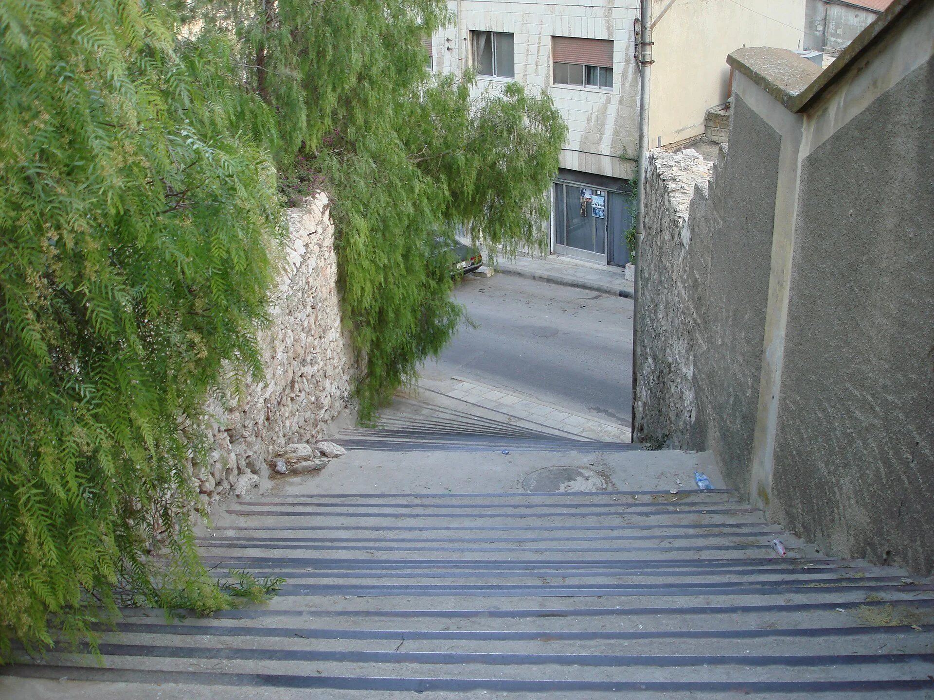
There is no fixed list. The Jordanian architect and urbanist Mohammad al-Asad, writing for the Center for the Study of the Built Environment in 2008, names six with confidence: Jabal Amman, Jabal al-Ashrafiyyeh, Jabal al-Hussein, Jabal al-Jofeh, Jabal al-Lweibdeh and Jabal al-Taj. For the seventh he offers Jabal al-Nasr, Jabal al-Qal'a or Jabal al-Nuzha. He calls the seven hills more urban legend than fact, pointing out that until the early 1970s the city already occupied more than seven. National Geographic Traveller gives the number of hills the city now covers as 19.
Until the early 1970s the hills were arranged around a single downtown in the valley, which held the city together. Al-Asad lists what it contained: the Central Bank, the headquarters of the Arab Bank, the central post office, several ministries, and the main shops, restaurants and cinemas. Residents moving from one hill to another usually passed through it, most often in shared taxis known locally as "service". The western hills, Jabal Amman, Jabal al-Hussein and Jabal al-Lweibdeh, were generally the more affluent areas, and Jabal al-Lweibdeh is still one of its oldest neighbourhoods.
From the 1970s the city spread beyond the hills, and public institutions and upper-end businesses left the downtown in the valley for new districts further out. The banking district moved to Shmeisani, and Sweifieh became the main shopping area, particularly for clothing. Al-Asad, writing in 2008, describes the small-scale, walkable neighbourhoods of the early 1970s as largely lost to this expansion. Today the city covers land far beyond the original seven hills and the single valley that once held its entire downtown.
WHY ARE AMMAN'S BUILDINGS MADE OF LIMESTONE?
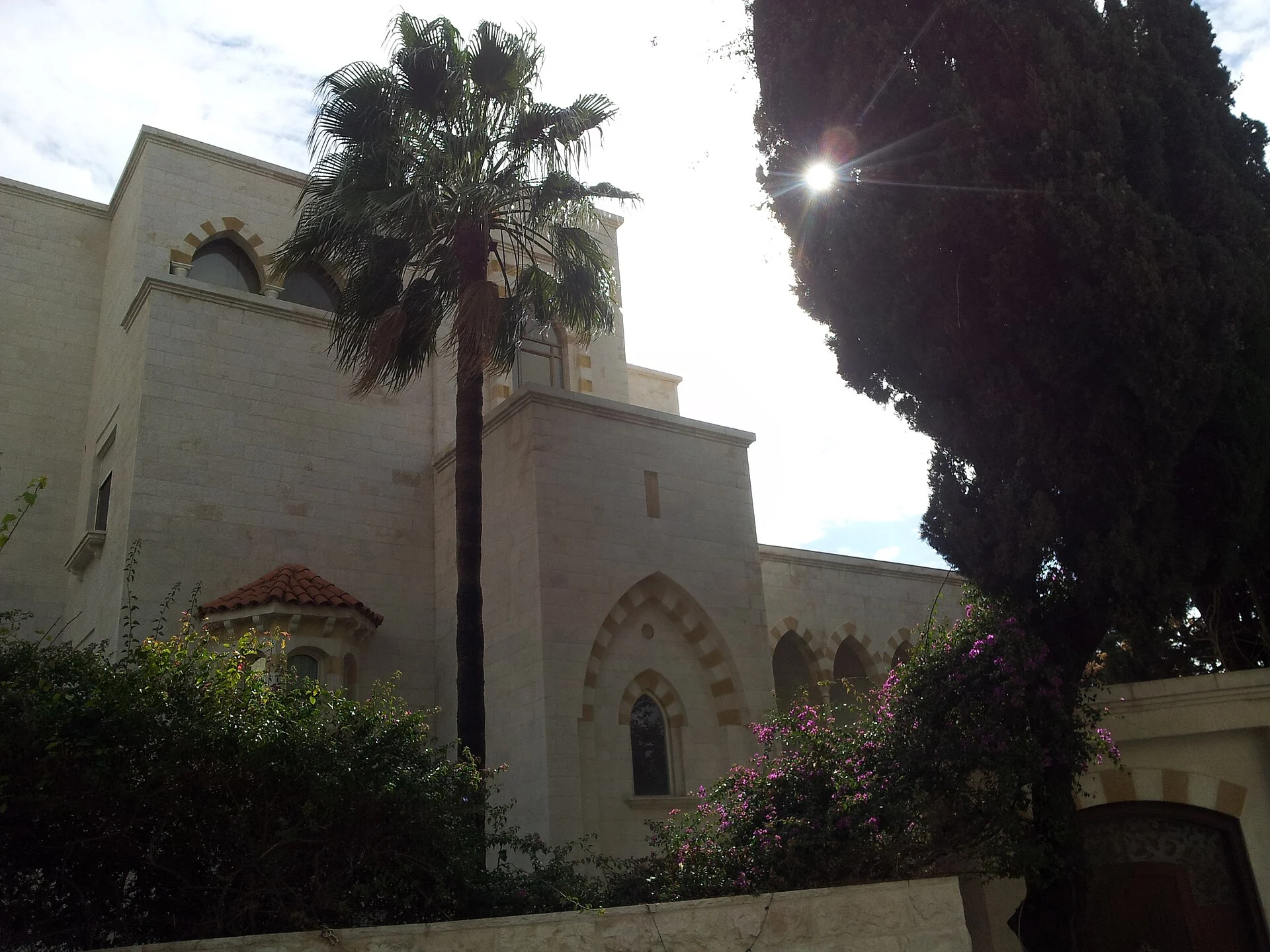
The city's uniform pale colour comes from limestone, the most quarried and used stone in Jordan. May Shaer's study for the Center for the Study of the Built Environment and the Conservation and Restoration Center in Petra, published in 2000, records that limestone is the near-universal cladding for façades in Amman. The best-graded white stone comes from Ma'an in the south, with other quarries at Ajlun, Irbid, al-Azraq and Salt. Amman's early houses were built by their builders rather than by architects, and architects were not fully entrusted with building design until the 1950s, around the founding of the Jordanian Engineers Association. Over the same period stone changed from a load-bearing material into a cladding laid over other structures.
Shaer's survey traces the changes decade by decade. In the 1920s and 1930s walls were faced in tubzeh dressing, laid in 25 centimetre courses with thin white or beige pointing. In the 1940s the finely tooled musamsam finish took over, with black recessed pointing. The 1980s brought the rough, split mufajjar finish and barrel-shaped blocks, and white pointing about 1 centimetre wide. By the 1990s 50 centimetre courses were common, alongside polished and saw-cut stone. Masons dressed the blocks with hand tools including the pitching tool (tumbor), the point chisel (shawkah) and the bush hammer (mattabeh).
AMMAN'S HILLS AND LIMESTONE AT W AMMAN

W Amman opened in April 2018 as the first W hotel in Jordan, and Silverfox Studios designed the full interiors of the 40-storey hotel. The design references two Jordanian landscapes: Amman's limestone hillside city, and Petra, with its rose-coloured rock and the canyon that leads into it. In Amman that stone is the limestone that May Shaer's survey records as the near-universal cladding of the city's buildings, laid over hills first built on at the Citadel and in the valley below.
The arrival sequence, the Canyon Walk, recalls the Siq, the narrow gorge through which visitors approach Petra, using angled planes and lines of light. Movement through the hotel is shaped around canyons and shards under a concept called Journey of Discoveries, and the building's façade is faceted into shard-like forms. The Siq is the canyon route into Petra, and its rose-coloured rock is the second of the two landscapes behind the design, alongside the stone-clad jabals of Amman. The two references shape both the faceted façade and the route a guest takes through the building.
SOURCES
- Department of Antiquities, Jordan Archaeological Sites: Amman
- Umayyad Route Visits: Amman
- Archnet Umayyad Palace at Amman
- Britannica Amman
- Encyclopedia.com (Encyclopedia of the Modern Middle East and North Africa; World Encyclopedia) Amman
- International Journal of Middle East Studies, Cambridge University Press Circassian Refugees and the Making of Amman, 1878 to 1914 (Vladimir Hamed-Troyansky, 2017)
- Center for the Study of the Built Environment A New Amman, for Better and for Worse (Mohammad al-Asad, 2008)
- Center for the Study of the Built Environment Stone as Wall Paper: The Use of Stone in Amman (May Shaer, 2000)
- National Geographic Craft, culture and cuisine in Amman, Jordan's mountain-fringed capital