
SANDSTONE MOUNTAINS, ROCK ART AND BEDOUIN LIFE IN SOUTHERN JORDAN
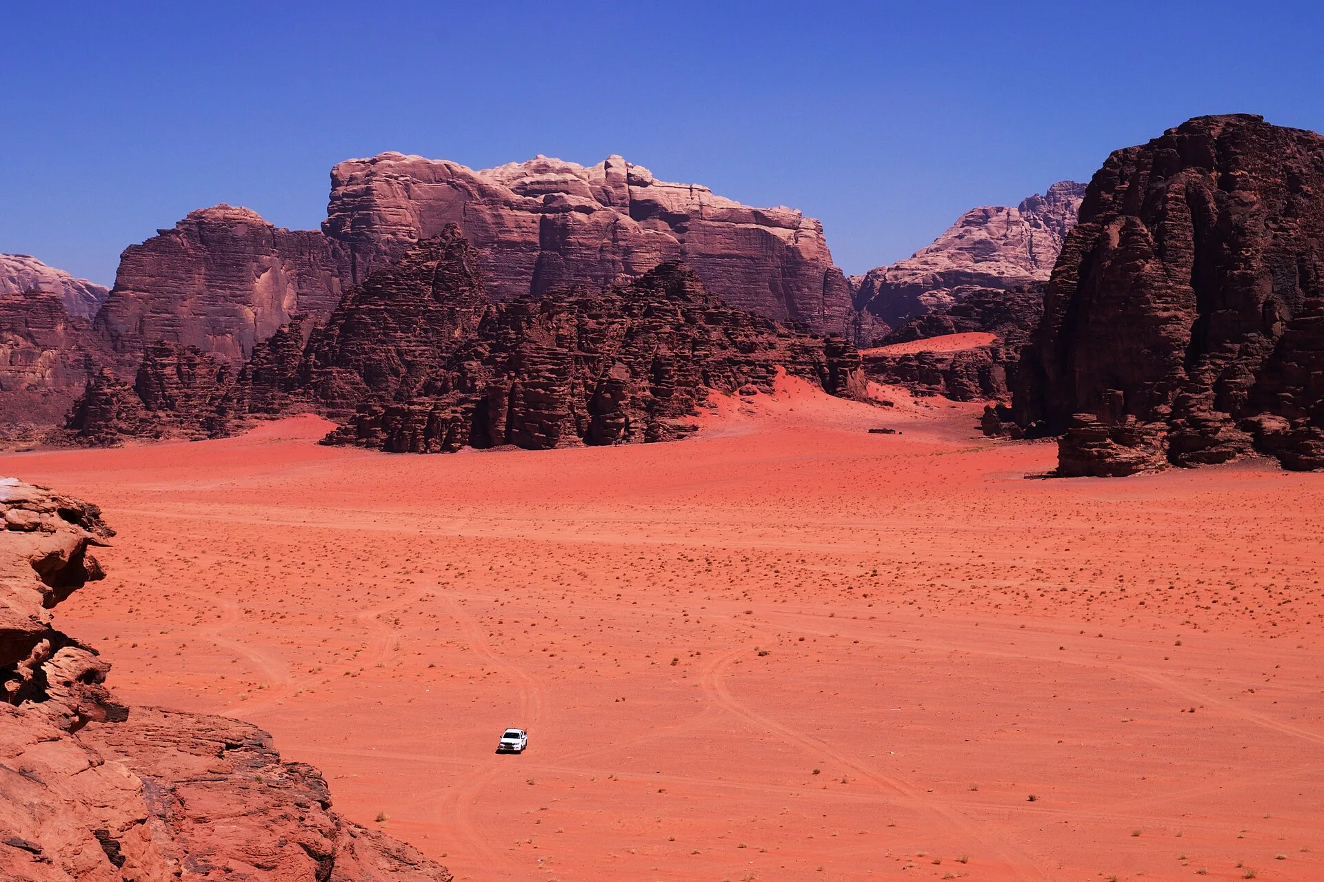
The Wadi Rum desert covers about 74,000 hectares of southern Jordan near the border with Saudi Arabia. The Jordan Tourism Board calls it "The Valley of the Moon". Its landforms were cut from Cambrian and Ordovician sandstones laid down on a granite basement, then lifted, faulted and eroded into gorges, natural arches, cliffs and isolated mountains. Petroglyphs, inscriptions and archaeological remains in the area record 12,000 years of human occupation, and in 2011 UNESCO inscribed the Wadi Rum Protected Area on the World Heritage List as a mixed natural and cultural site. Bedouin communities still live in and around the protected area, and their pastoral knowledge is recognised by UNESCO as intangible heritage. The desert has stood in for Mars in Hollywood feature films, and in 2017 it received 162,000 visitors.
WHERE IS THE WADI RUM DESERT?
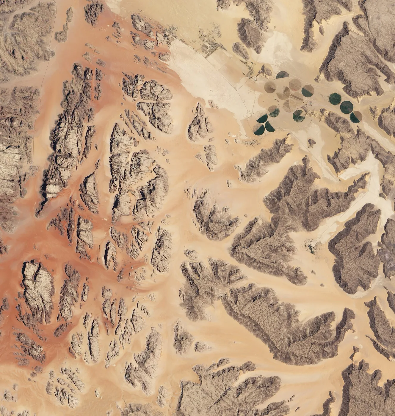
Wadi Rum lies east of the Rift Valley, south of the escarpment that marks the edge of the central Jordanian plateau. According to UNESCO, it was first identified as a potential nature reserve in 1978. The Wadi Rum Protected Area was established by cabinet decision in 1997 and extended in 2002; ICOMOS records that it grew from 54,000 hectares to 72,000 hectares in that period. The property listed by UNESCO covers 74,200 hectares, surrounded by a buffer zone that is mostly a 5 kilometre perimeter. The village of Rum, inside the protected area but outside the listed property, is limited to 40.4 hectares.
The World Heritage Committee inscribed Wadi Rum at its 35th session, held at UNESCO Headquarters in Paris from 19 to 29 June 2011. It was listed under three criteria. Criterion (vii) recognises it as an iconic desert landscape of sandstone mountains, natural arches, narrow gorges, towering cliffs and honeycomb weathering. Criterion (iii) covers the rock art, inscriptions and archaeological sites as testimony to the cultural traditions of early inhabitants. Criterion (v) covers the way communities adapted to scarce resources in a semi-arid desert and kept a continuous presence after the climate became drier in the Bronze Age.
HOW DID THE WADI RUM DESERT FORM?
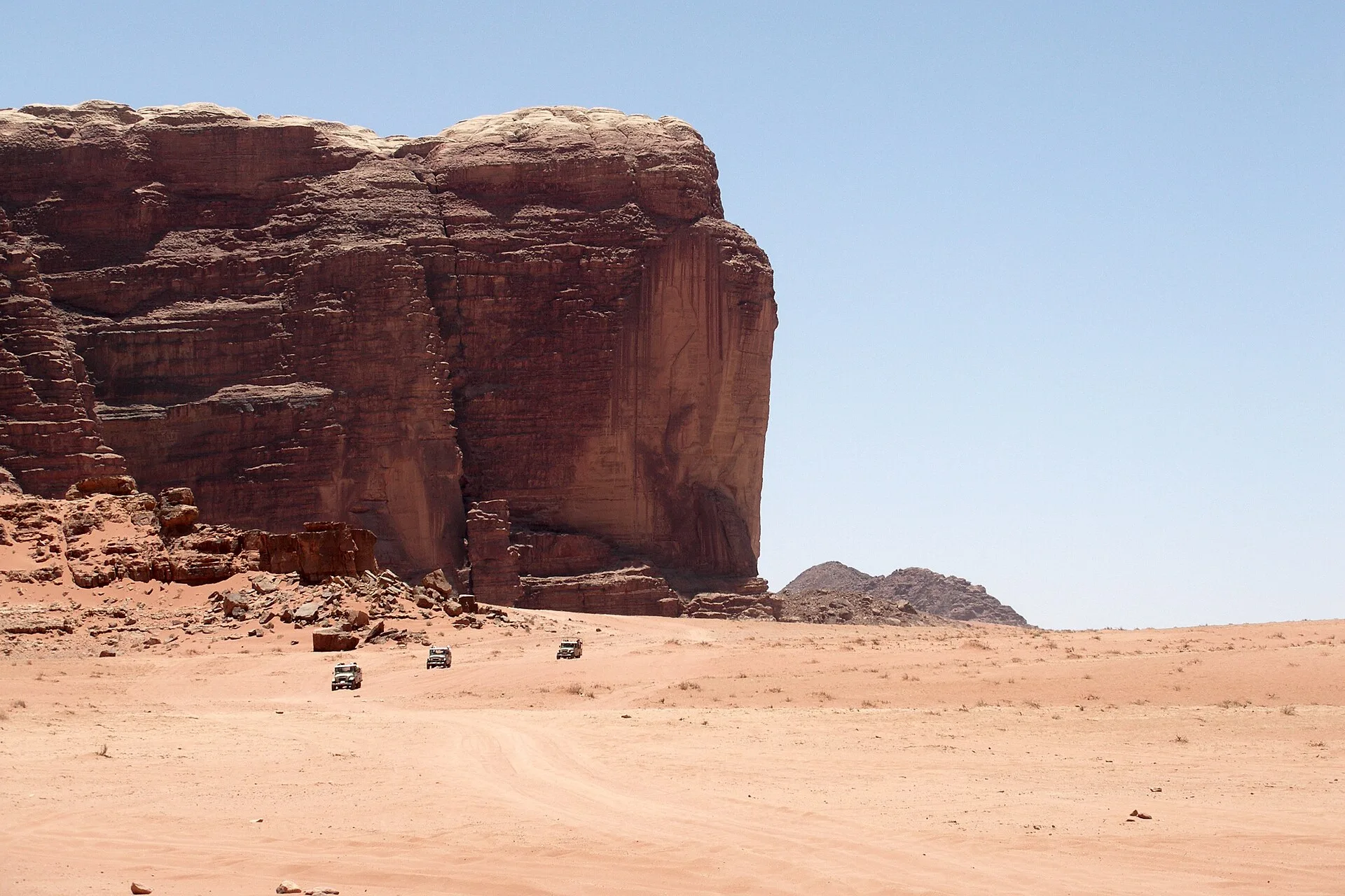
The oldest rocks in the area belong to the Precambrian basement complex of south Jordan. In a 1975 survey of Jordan's geology for the US Geological Survey, F. Bender described granite, diorite and related rocks as its main constituents, with biotite aplite granite the most common plutonic rock and potassium argon ages of about 580 to 592 million years. At the start of the Cambrian, this basement was worn down to a flat erosion surface, or peneplain. East of Wadi Araba, bedded sandstone up to 200 metres thick rests directly on this eroded Precambrian surface, and Bender's Quweira unit, which includes massive brownish sandstone of continental origin, is as much as 350 metres thick altogether.
Above these Cambrian beds sits the Ordovician Ram Sandstone, named by the geologist Quennell in 1951. Bender describes it as massive, whitish weathering sandstone deposited in an alternating continental and deltaic marine environment, as much as 300 metres thick in the Khawr Ramm and Qa' Disah area. Over it lies about 250 metres of bedded sandstone known as the Umm Sahm Sandstone. Its original colours were pink, beige, grey brown and, higher up, white, but desert varnish makes its weathered surfaces look dark brown or black. Bender notes that east of Wadi Ram these sandstones cover the basement completely and form steep cliffs and mountains more than 1,700 metres high.
HOW THE CANYONS, ARCHES AND MOUNTAINS OF WADI RUM JORDAN TOOK SHAPE
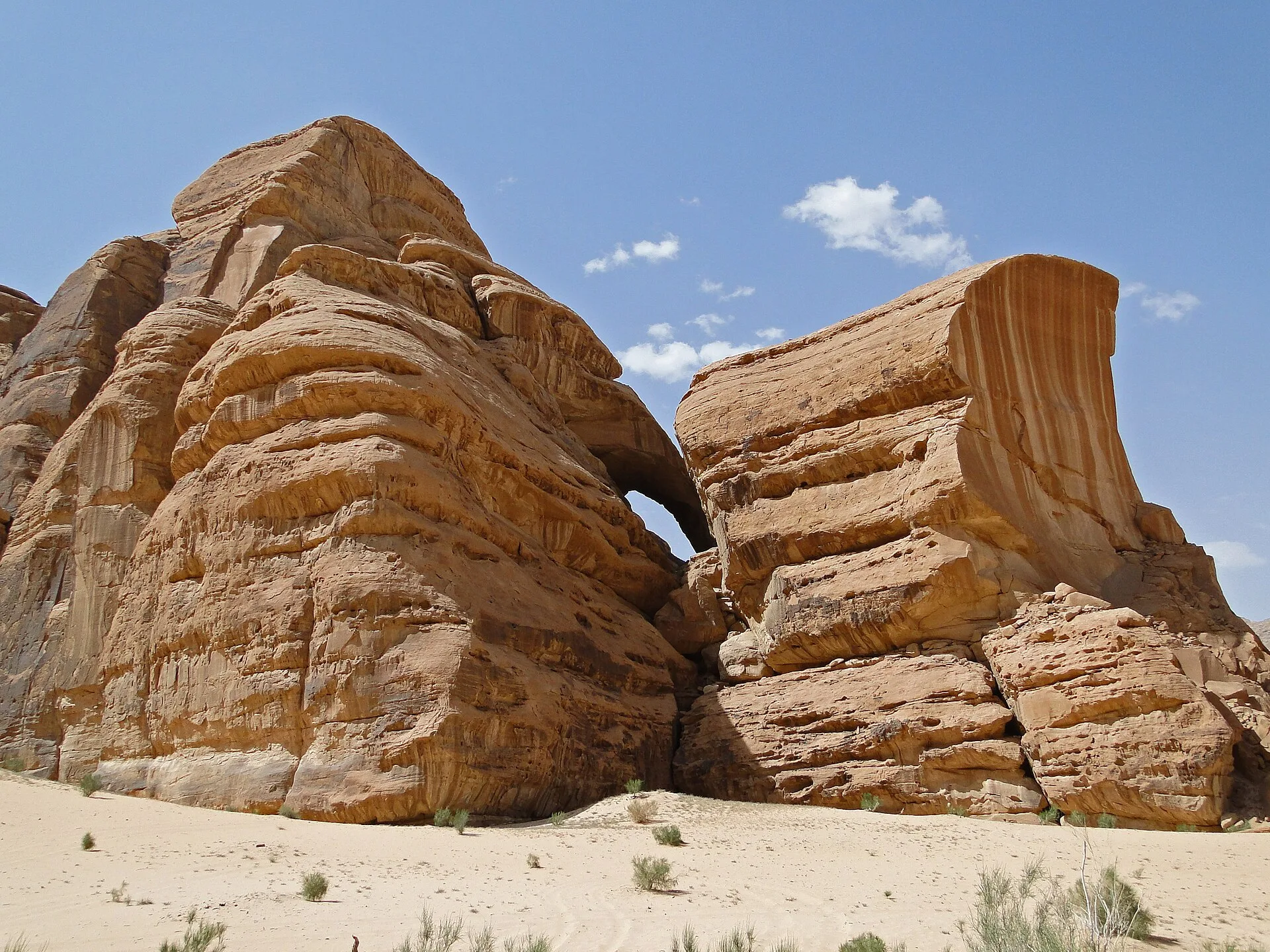
The present relief is much younger than the rock. ICOMOS, in its evaluation for the World Heritage Committee, describes the surrounding Hisma basin as mainly a Palaeozoic sandstone plateau with elevations up to 1,850 metres. Uplift in the Tertiary period raised the Jordanian tableland and opened a grid of geological faults around 20 million years ago. Erosion concentrated along these fault lines produced what ICOMOS calls a large scale "chequer-board" landscape of massifs separated by valleys. Continued uplift and erosion cause sections of cliff to collapse, leaving debris on the valley floors and isolated remnants of larger massifs, known as inselbergs.
UNESCO attributes the variety of landforms to lithology, tectonic uplift, faults and joints, and weathering and erosion. The result includes narrow gorges, natural arches, ramps, massive landslides and caverns, and honeycomb weathering features that UNESCO counts among the most spectacular in the world. Bender gives the height of Jabal Ram, one of the main sandstone massifs, as 1,754 metres. The Jordan Tourism Board lists Jabal Rum, Jabal Um Ishrin, Jabal Khazali and Jabal Qattar among the named peaks, and describes the country south of Rum towards Aqaba as sandstone domes and granite mountains striated with basalt dyke intrusions.
12,000 YEARS OF ROCK ART AND INSCRIPTIONS
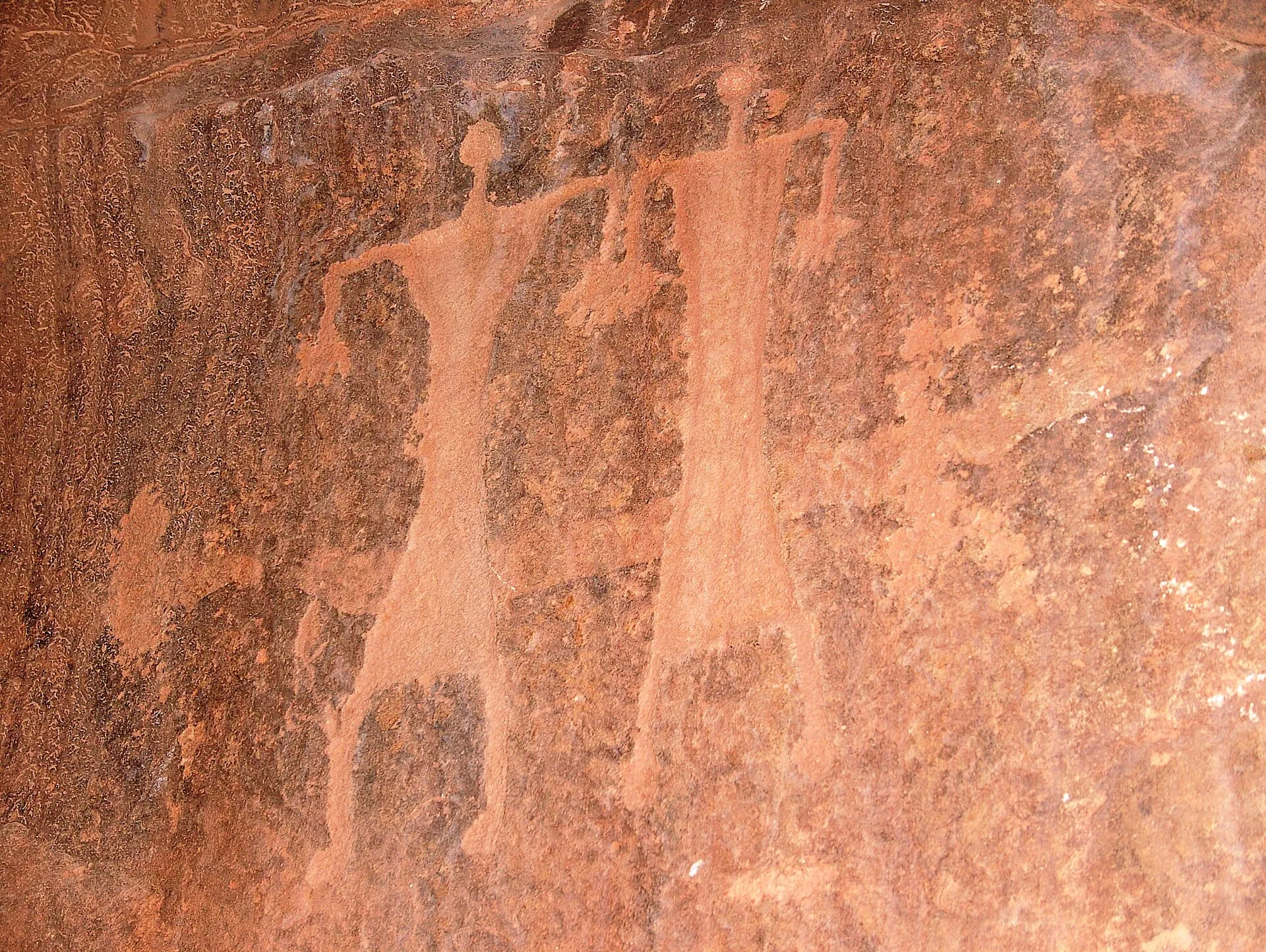
UNESCO counts 25,000 petroglyphs, 20,000 inscriptions and 154 archaeological sites in the property, showing continuous habitation and land use for at least 12,000 years. ICOMOS lists Abu Nakheileh and Ruais Salim as the largest Neolithic sites, dated 8,300 to 4,500 BC, with remains of circular or rectangular stone houses probably used by semi sedentary groups living on local wildlife and plants. Udayb er-Rih, described as a large Neolithic agricultural settlement, has traces of olive farming and early hydraulic installations still used by Bedouin herders. In the drier Bronze Age, people built channels, dams and reservoirs near the mountain slopes and combined animal husbandry with agriculture.
The rock art shows human and animal figures and abstract forms, including domesticated animals such as cattle and camels and hunting scenes. ICOMOS notes that only rock art linked to inscriptions can be dated accurately. The earliest dated texts, known as Thamudic, are 3,530 to 2,120 years old; ICOMOS describes the Lihyanite, Safaitic and Aramaic writing systems as developing from them, Nabataean from Aramaic and Arabic from Nabataean. UNESCO records inscriptions in four different scripts, which it reads as evidence of widespread literacy among pastoral societies. In the cleft of Jabal Khaz'ali, recorded by the scholar Savignac in 1932, Thamudic and Kufic inscriptions appear beside drawings of people, feet and animals.
THE NABATAEANS AND THE TEMPLE AT RUM
From their base at Petra, the Nabataeans controlled the trade route linking the Arabian Peninsula to the Mediterranean, used for frankincense and myrrh from Arabia and copper from Wadi Araba. ICOMOS records their water engineering across the Wadi Rum area. A Nabataean dam, Bir Rum Al-Atiq, lies across the northern entrance to Wadi Rum. Jebel Burdah has a major Nabataean dam with inscriptions, and Jebel Kharazeh, outside the buffer zone, has several dams. ICOMOS also notes that the Nabataean water reservoirs are now badly deteriorated.
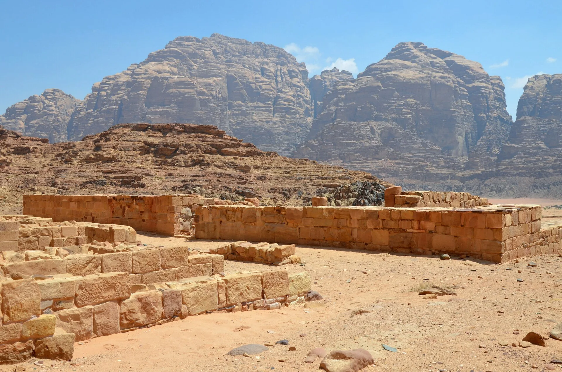
Near the village of Rum stand the remains of a temple to the pre-Islamic goddess Allat. According to ICOMOS, the Nabataean temple was first built in the reign of Aretas IV (9 BC to 40 AD) on the site of an earlier Thamudic temple, and went out of use by the 4th century AD. A Thamudic inscription naming the tribe of 'Ad was found on a stone reused in its second building phase, and another inscription records the founding of the original temple by a member of that tribe. The building is thought to have served as a civic and administrative centre as well as a place of worship. The University of Victoria, Canada, excavated a bath complex near the temple in the late 1990s, and the nearby Ain Shallaleh spring is one of the main springs feeding the temple and village area.
BEDOUIN LIFE IN THE WADI RUM DESERT
UNESCO first proclaimed the Cultural Space of the Bedu in Petra and Wadi Rum as intangible heritage in 2005, then inscribed it on the Representative List of the Intangible Cultural Heritage of Humanity in 2008. The listing describes a traditional pastoral culture and its skills: knowledge of local flora and fauna, traditional medicine, camel husbandry, tent making, and tracking and climbing. UNESCO notes that the Bedu have an extensive knowledge of their environment and a complex moral and social code, passed on orally, with poetry, folktales and songs tied to specific places. Related textile traditions are covered in our article on Bedouin weaving in Jordan.
The same listing records that over the last fifty years more Bedu groups have settled, as education, housing, health care and sanitation made a sedentary life more attractive. The official site of the late King Hussein describes several Bedouin tribes living in scattered camps across the area, and the village of Rum with its goat hair tents and concrete houses. ICOMOS counts six Bedouin groups living inside or around the protected area, moving seasonally and drawing income from tourism, grazing or farming. Visitor tours run within the tribal territories of the Disi and Rum communities, two permanent community representatives sit on the site management committee, and locally run bed and breakfast accommodation is offered alongside licensed camps.
WADI RUM ON FILM AND VISITING TODAY
The Jordan Tourism Board notes that Wadi Rum has been depicted as Mars in several Hollywood feature films. The official King Hussein site records that much of David Lean's Lawrence of Arabia was filmed there. For Ridley Scott's The Martian (2015), Slate reported that many exteriors were shot in the Wadi Rum desert, which it called a frequent stand-in for the fourth planet from the Sun. Empire magazine reported that Denis Villeneuve chose to shoot Dune in the Wadi Rum desert rather than against green screen.
According to ICOMOS, all visitors are required to enter through the Visitors' Centre built in 2003, and most take a vehicle tour to the best known sites, with up to 80 tours on peak days. At the time of the evaluation, tourists stayed at 28 licensed camp sites. The Jordan Times reported 162,000 visitors to Wadi Rum in 2017, a 97 per cent increase on the 82,000 recorded in 2016. UNESCO names visitor pressure, especially car tracks and tourism infrastructure, among the main threats to the property, along with groundwater extraction and firewood collection.
The Jordan Tourism Board lists hot air balloon flights from the Disi area, microlight flights, 4x4 tours booked through a camp or the visitor centre, horse riding, camel racing and stargazing sessions with telescopes. Pottery workshops are held at the Disi Women's Cooperative, and visitors can join a traditional majlis with tea, coffee and dates. Rum village is a stop on the Jordan Trail: the Petra to Wadi Rum stretch runs about 125.4 kilometres over six hiking days, and the Wadi Rum to Aqaba stretch about 75.9 kilometres over five days, ending at the Red Sea.
CANYONS AND ROCK IN THE DESIGN OF W AMMAN

W Amman opened in April 2018 as W's first hotel in Jordan, and Silverfox Studios designed the full interiors of the 40-storey hotel. The design takes its references from two places. The first is Petra, the base from which the Nabataeans controlled the trade route linking the Arabian Peninsula to the Mediterranean, with its rose rock and its canyon. The second is Amman, a city of limestone buildings spread across its hillsides. Wadi Rum and Petra both lie in southern Jordan, but Wadi Rum is not one of the stated references for the hotel.
The arrival sequence, called the "Canyon Walk", recalls the Siq, Petra's entrance gorge, through angled planes and lines of light. Beyond the arrival, movement through the hotel is shaped like canyons and shards, a sequence titled the "Journey of Discoveries". The canyon idea continues on the outside of the building, where the façade is faceted and shard-like. In Wadi Rum, ICOMOS describes gorges cut by erosion along fault lines and massifs broken into isolated remnants; at W Amman, the canyon and the shard are used as design forms across the façade, the arrival and the routes through the building.
SOURCES
- UNESCO World Heritage Centre Wadi Rum Protected Area
- UNESCO World Heritage Centre World Heritage Committee inscribes new sites, 2011
- ICOMOS and IUCN, UNESCO World Heritage Centre Advisory body evaluation: Wadi Rum Protected Area (No 1377)
- UNESCO Intangible Cultural Heritage Cultural space of the Bedu in Petra and Wadi Rum
- US Geological Survey Bender, F. (1975) Geology of the Arabian Peninsula: Jordan
- Jordan Tourism Board Wadi Rum
- King Hussein Bin Talal (official site) Tourism in Jordan: Wadi Rum
- The Jordan Times 97 per cent increase in Wadi Rum visitors, 13 per cent in Aqaba
- Slate The Martian reviewed
- Empire Dune: Timothée Chalamet on the awe-inspiring desert shoot