
FROM THE LAKE TAI PLAIN TO THE BUND, LUJIAZUI AND THE EXPO 2010 WATERFRONT

The Huangpu River, 60 to 70 miles long depending on the source, flows past Shanghai to the Yangtze estuary at Wusong, dividing the city into Puxi on the west bank and Pudong on the east. Drainage and flood control works reshaped the Lake Tai plain between the 10th and 15th centuries, and a dredged channel now gives oceangoing ships access to the city. On the west bank, the surviving buildings of the Bund date from 1886 or earlier to 1948. Opposite, Lujiazui grew from farmland after 1990 into a district of supertall towers, the industrial riverbanks between the Nanpu and Lupu bridges became the site of Expo 2010, and by 2017 more than half of the downtown riverfront had been opened to the public.
WHERE DOES THE HUANGPU RIVER RISE AND HOW LONG IS IT?
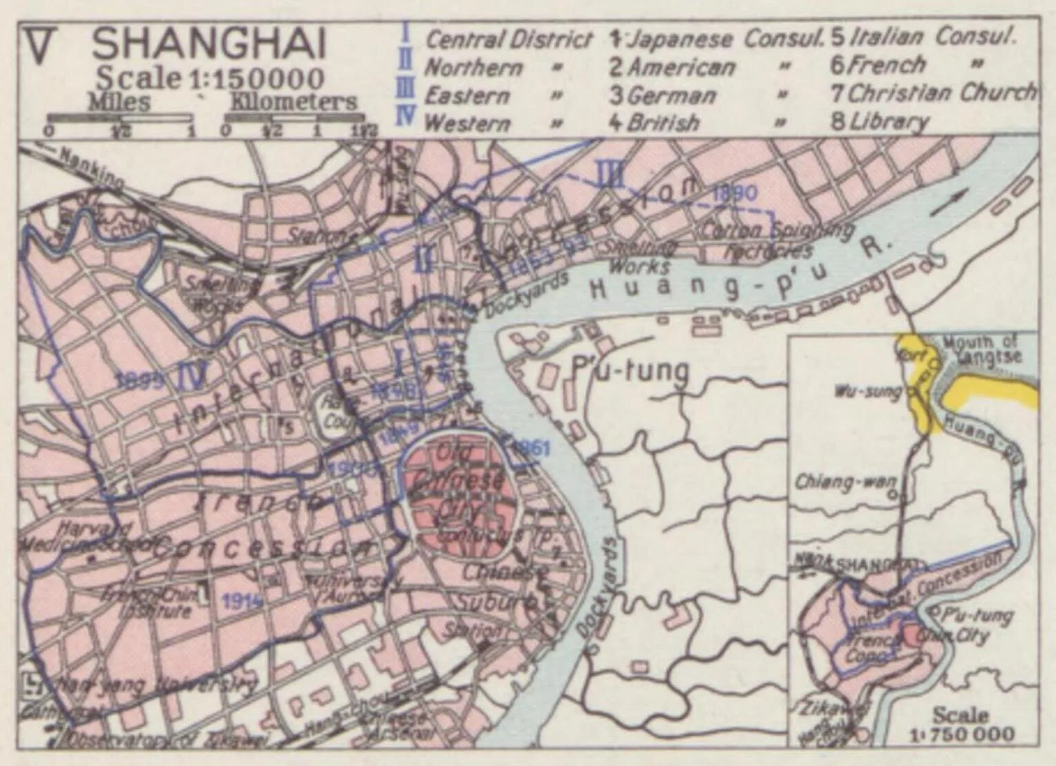
Britannica describes the Huangpu as a 70-mile-long river in eastern China that flows past Shanghai and joins the Chang (Yangtze) River, of which it is a tributary. The Columbia Encyclopedia gives a shorter length of about 60 miles (97 km) and describes the river rising in the lake district of Shanghai Municipality, then flowing northeast past the city into the Yangtze estuary at Wusong. Britannica's entry on Lake Tai lists the Huangpu, together with the Wusong and Liu rivers, among the channels through which the lake discharges east into the East China Sea.
The river system around Shanghai is the product of centuries of water engineering on the Lake Tai plain. Britannica records that the irrigation system around the lake dates mostly from the 7th century AD onward, that reclamation and drainage improvements were carried out intensively between the 10th and 13th centuries, and that large-scale flood control works followed in the 11th century and again in the 15th. The Columbia Encyclopedia describes the Huangpu as a major navigational route whose dredged channel, lined with wharves, warehouses and industrial plants, gives oceangoing vessels access to Shanghai.
Britannica places Pudong on the east bank and the central business district of Puxi on the west, and identifies the confluence of the Huangpu and the Suzhou River as the centre of Shanghai. The Huangpu is also the city's main source of water. Britannica records that industrial discharge, domestic sewage and waste from ships have heavily polluted it, and the Columbia Encyclopedia notes that the growing city faced water shortages and polluted drinking water, and that a project to divert water from the Yangtze to the Huangpu was completed in 1996.
HOW DID SHANGHAI'S PORT GROW ALONG THE BUND?
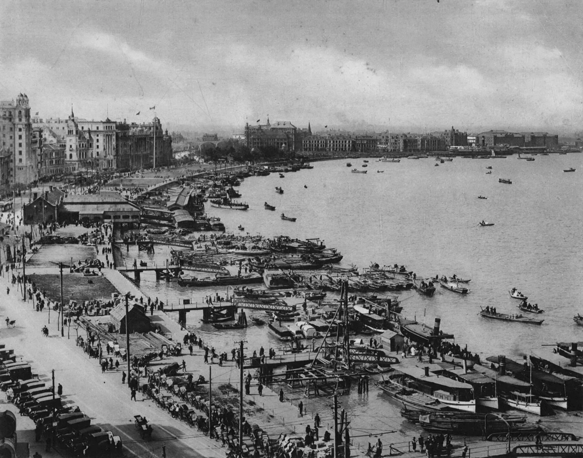
In Shanghai the bund was the waterfront along the Huangpu's west bank, where banks, trading houses and shipping companies built their offices. HSBC's archive records that the bank opened for business in Shanghai on 3 April 1865 from premises on the bund. A building guide compiled by Marilyn Shea for the University of Maine at Farmington dates the earliest buildings on its list: the Russell & Co. building, built in 1886 or earlier as the offices of Russell & Company; the China Merchants Steamship Company building of 1901, built for an English business; the Russo-Asiatic Bank, also of 1901; and a bank building of 1907 later bought by the Commercial Bank of China.
Most of the other buildings in the guide date from the first three decades of the 20th century. The Palace Hotel was built from 1906 to 1908 on the site of the Central Hotel, founded in 1903. The Shanghai Club, an exclusive men's club designed by T. Tarrant of London, was built and opened in 1910 and held its grand opening in January 1911. The Asiatic Petroleum Building dates from 1916, the Yangtze Water and Fire Insurance Company building from 1920, the offices of Jardine Matheson and the Union Assurance building from 1922, and the building of the Nisshin Kisen Kaisha steamship company from 1925. The China Bank of Communications was completed in 1948 on a site earlier occupied by the Deutsch-Asiatische Bank.
WHICH BUILDINGS DEFINE THE BUND'S ARCHITECTURE?
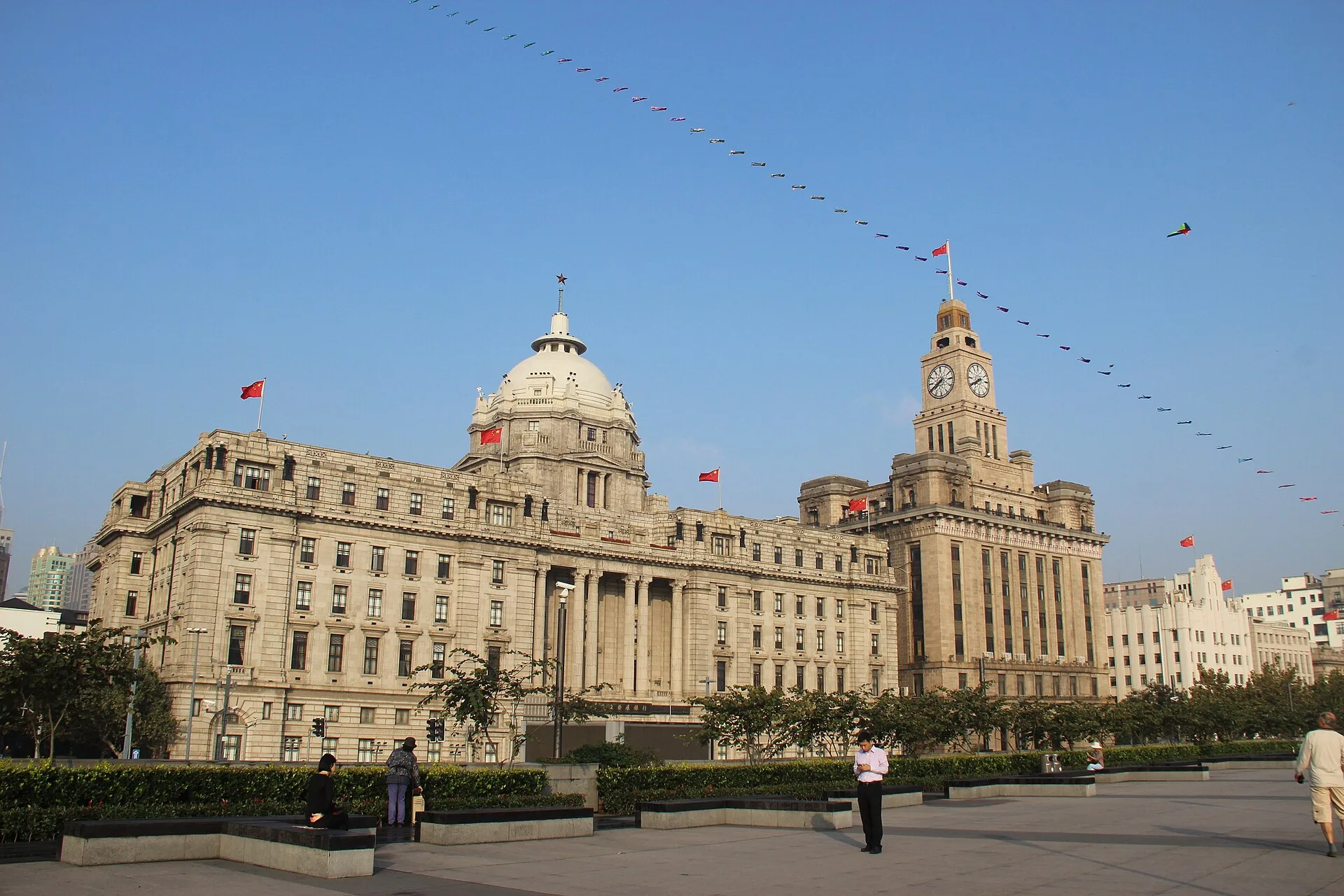
HSBC commissioned a new Shanghai office in 1919. According to its archive, Alexander Stephen, the bank's Shanghai Manager, wanted an office that reflected HSBC's standing in the city, and the brief to the architects Palmer and Turner was “Spare no expense, and dominate the bund!” The building was officially opened on 23 June 1923. The archive's photographs show a banking hall, an octagonal hall, a marble staircase, a Chinese department and a manager's office. The Maine building guide attributes the lions at the entrance to W. W. Wagstaff.
The Maine guide credits Palmer and Turner with the Yokohama Specie Bank, built from 1923 to 1924, the Customs House of 1927, the Cathay Hotel of 1929 and, with the architect Lu Qianshou, the Bank of China building of 1937, which the bank occupied from 1946. Other buildings of the same decade include the Chartered Bank of 1923, the Bank of Taiwan of 1924, which replaced an earlier building on its site, and the offices of the North China Daily News, completed in February 1924.
The Cathay Hotel was built for Victor Sassoon and combined a hotel with offices. Hospitality Design reported in July 2010 that the building, which originally opened in 1929, had reopened as the Fairmont Peace Hotel after a three-year restoration by the design firm HBA, working with designers, architects and historians to re-create its Art Deco heritage. The magazine listed a copper-sheathed roof, white Italian marble floors and Lalique glass artwork among the hotel's features. Its reopened restaurants and lounges included the Jazz Bar, described by the magazine as a Shanghai institution since the 1930s, and a new presidential suite was to occupy the 10th-floor penthouse where Sassoon had lived.
HOW DID LUJIAZUI AND PUDONG BUILD SHANGHAI'S SKYLINE?
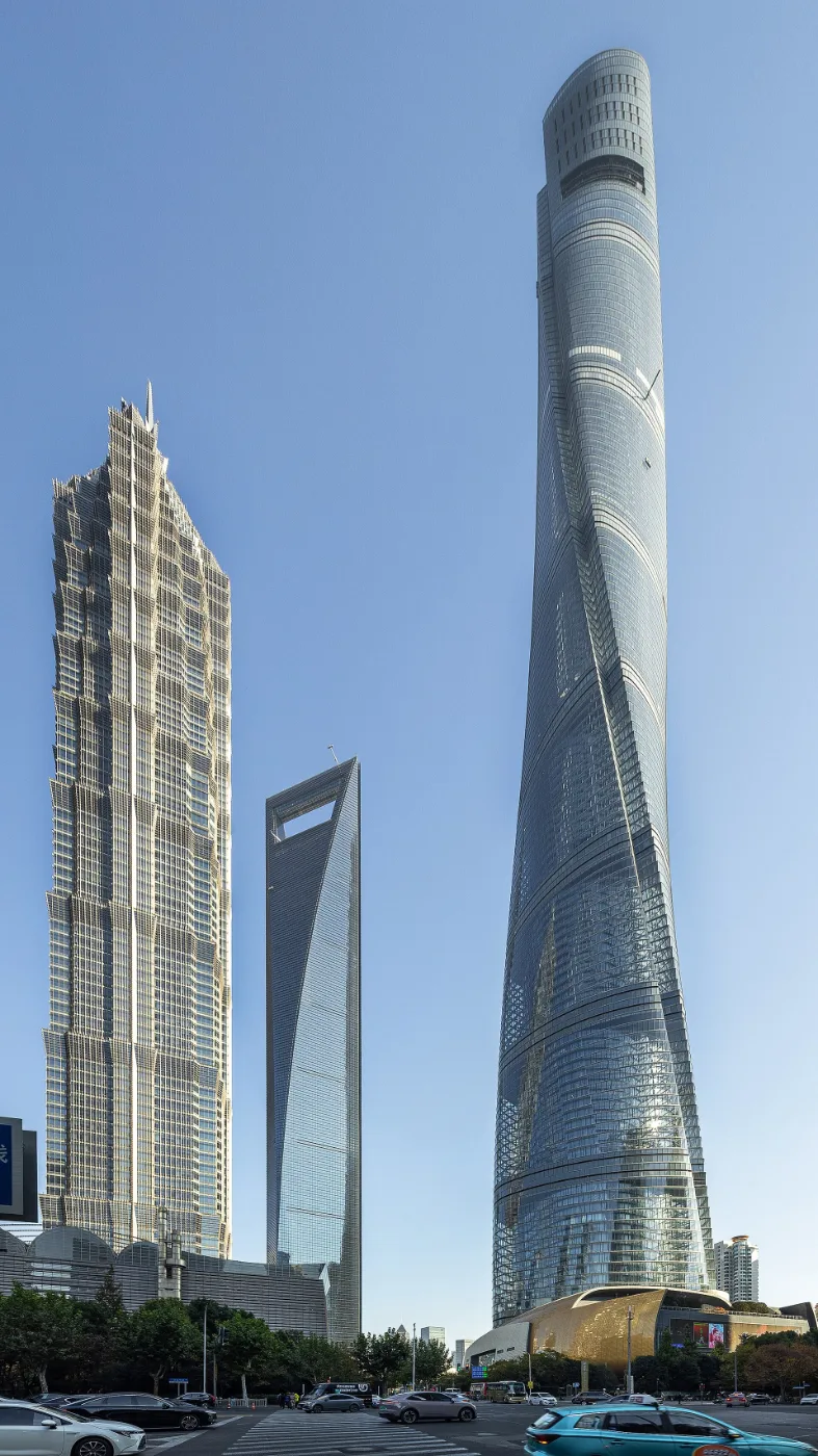
Lujiazui occupies a meander on the Huangpu's east bank, directly opposite the Bund. A satellite image study by CNES, the French space agency, describes the district as almost exclusively agricultural 30 years before its study. Lujiazui became part of the Pudong development zone defined in 1990 and officially launched in 1993, and the district now covers 32 square kilometres. Britannica notes that modern skyscrapers dominate the Pudong skyline, and the CNES image shows the towers of Lujiazui concentrated inside the river bend, with the Huangpu reaching the Yangtze delta a few kilometres further east.
CNES dates the opening of the Oriental Pearl Tower, 468 m tall, to 1994. The Jin Mao Tower followed in 1999, at 420 m and 88 floors. The Shanghai World Financial Center, built from 1997 to 2008, reached 492 m and 101 floors at a cost of 1.2 billion dollars. The Shanghai Tower, begun in 2008 and opened in February 2015, rises 632 m over 128 floors, with about 510,000 square metres of floor area, 106 lifts running at up to 20.5 m per second, 258 hotel rooms and 1,800 parking spaces.
Between Lujiazui and the Bund the river is crossed by tunnel and ferry. CNES counts six large road tunnels and three underground metro lines linking Lujiazui to the west bank, alongside a ferry crossing that appears in the satellite image as a line of small white boats. Elsewhere in the central city the Huangpu is spanned by bridges, among them the Nanpu and Lupu bridges, which marked the ends of the Expo 2010 site, and the Yangpu and Xupu bridges, between which the city opened its downtown riverside paths.
HOW WERE THE HUANGPU'S INDUSTRIAL RIVERBANKS OPENED UP?

The Bureau International des Expositions records that Expo 2010 occupied the area between the Nanpu and Lupu bridges in the centre of Shanghai, on both sides of the Huangpu, and that much of the site had previously been occupied by shipyards and ageing factories. Parts of the industrial riverbank were reused rather than cleared: according to the BIE, a former steel mill was turned into a sculpture garden and the Nanshi Power Plant became one of the Expo's theme pavilions.
At 523 hectares it was the largest site in World Expo history. The Expo ran from 1 May to 31 October 2010 under the theme Better City, Better Life. The BIE puts attendance at 73,085,000 visitors, surpassing the 64 million recorded at Expo 1970 Osaka, with 246 countries and international organisations taking part. Which structures were dismantled, rebuilt abroad or converted into museums and venues after the closing is set out in Expo 2010 Shanghai: what happened to the pavilions.
A news report published by the Information Office of Shanghai Municipality on 6 July 2017 stated that more than half of the Huangpu riverfront in downtown Shanghai was by then open to the public. The open section measured 25.29 km of riverside between the Yangpu and Xupu bridges, and ran through Yangpu, Hongkou, Huangpu and Xuhui districts and the Pudong New Area. The report described continuous routes for walking, running and cycling, with the historic buildings along the river preserved. It gave the city government's target as 45 km of open waterfront by the end of 2017. The stated aim was a riverside attraction “on a par with the Left Bank in Paris and London's Thames walkways”.
THOMPSON SHANGHAI EXPO ON THE FORMER EXPO 2010 SITE

Thompson Shanghai Expo opened in October 2025 as Thompson's first hotel in Asia Pacific, with 254 rooms, and Silverfox Studios designed its full scope. The hotel stands on the former Expo 2010 site and faces the Huangpu. The BIE places that 523-hectare site in the centre of Shanghai, between the Nanpu and Lupu bridges and on both banks of the river, where 246 countries and international organisations took part from May to October 2010. The design avoids literal pavilion imagery.
Its organising idea is “buildings within buildings”: each public room and each guestroom type is its own structure, with its own ceiling and materials. On levels 19 to 20, the Fishermen's Pavilion is the all-day dining restaurant, arranged as penthouse pavilions facing the river and the Expo grounds. Before 2010, much of that land was occupied by shipyards and ageing factories; for the Expo, a former steel mill became a sculpture garden and the Nanshi Power Plant a theme pavilion.
SOURCES
- Britannica Huangpu River
- Britannica Lake Tai
- The Columbia Encyclopedia, Columbia University Press (via Encyclopedia.com) Huangpu
- HSBC History A Shanghai landmark
- University of Maine at Farmington Marilyn Shea, The Bund: Picture Guide to Historic Buildings
- Hospitality Design Fairmont Peace Hotel Opens in Shanghai
- CNES, Géoimage Shanghai: mutations du quartier de Lujiazui, une nouvelle place financière mondiale
- Bureau International des Expositions Expo 2010 Shanghai
- Information Office of Shanghai Municipality Huangpu riverside plan reaches halfway stage