
ARABIA'S GREAT SAND SEA, FROM ANCIENT LAKES TO CAMEL CROSSINGS
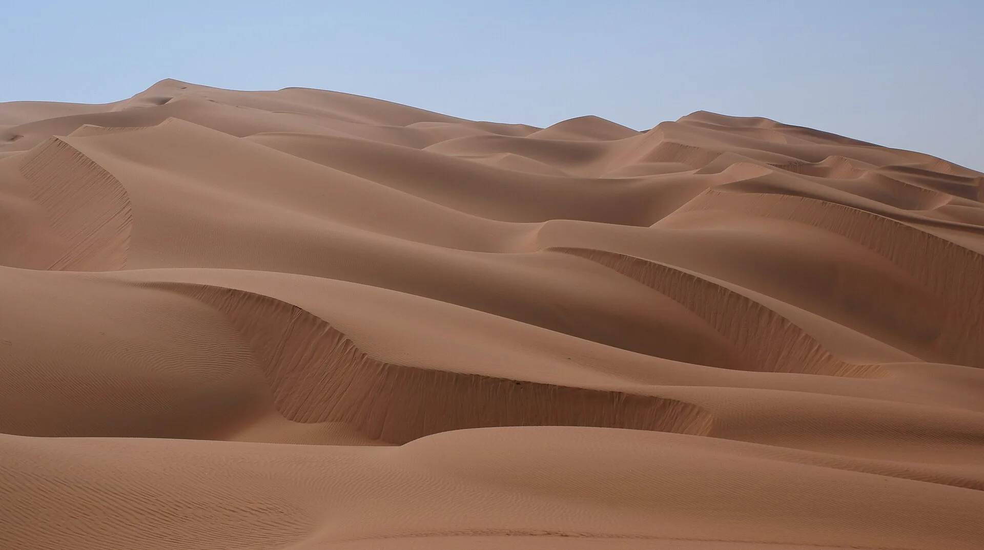
The Rub' al Khali desert, the Empty Quarter, covers about 650,000 square kilometres of the southern Arabian Peninsula and is, according to Britannica, the largest area of continuous sand in the world. It sits in a structural basin, mainly in south-eastern Saudi Arabia, with smaller parts in Yemen, Oman and the United Arab Emirates. Its sediments record a wetter past of lakes, rivers and grazing animals that ended about 6,000 years ago. Frankincense caravans took on water at the oasis of Shisr near its southern edge, Bedouin tribes such as the Rashid and Bayt Kathir travelled its sands, and two travellers, Bertram Thomas in 1930 to 1931 and Wilfred Thesiger in the late 1940s, crossed it by camel with Bedouin guides. Today part of its western edge is a UNESCO World Heritage site where the Arabian oryx has been returned to the wild.
WHERE IS THE RUB AL KHALI DESERT AND HOW BIG IS IT?
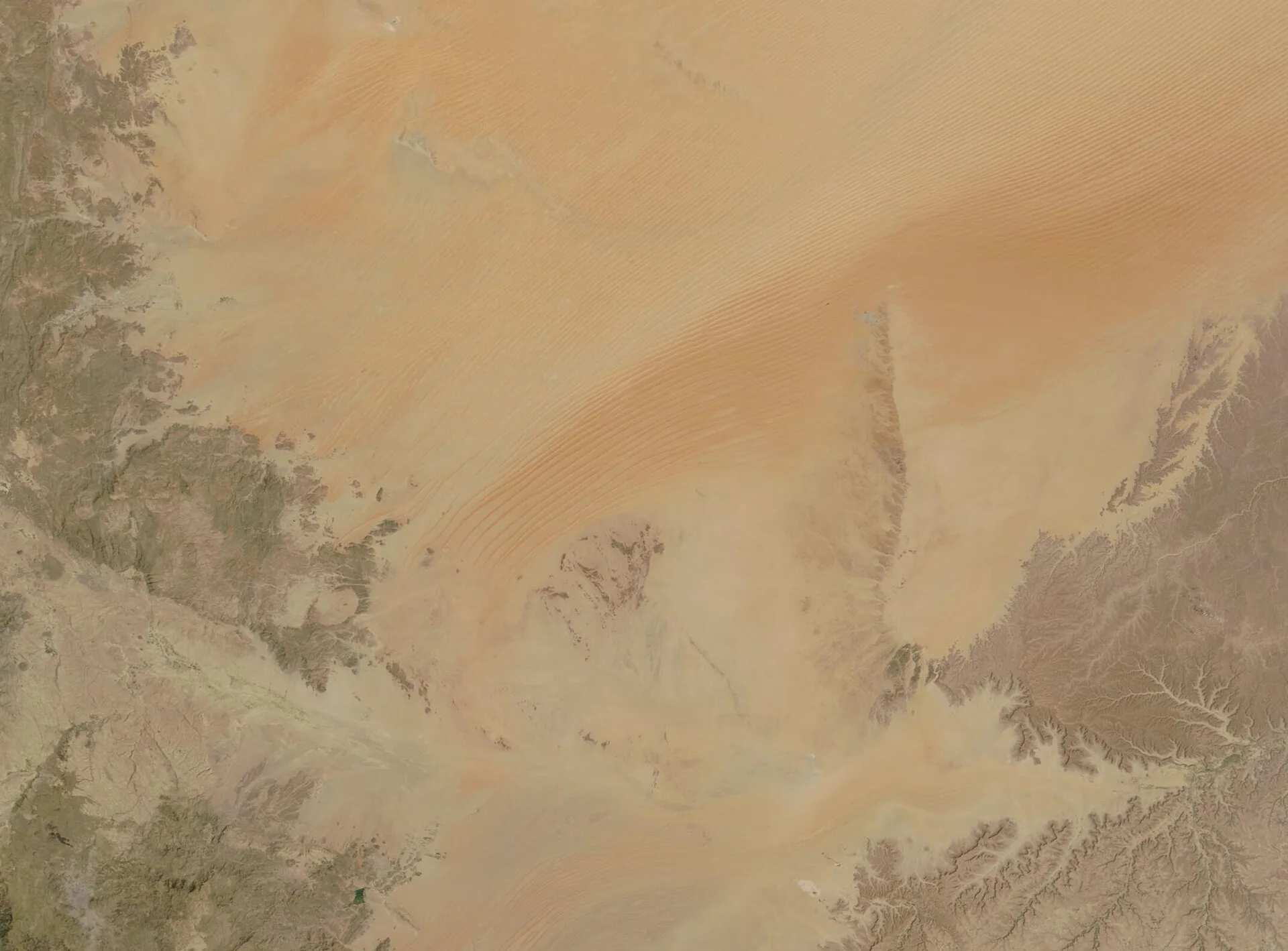
The Rub' al Khali is the largest part of the Arabian Desert and occupies more than a quarter of Saudi Arabia's total area. Britannica gives other names for it, including Ar-Ramlah, or simply "the Sand". The ground falls from about 610 metres above sea level in the west, where the sand is fine and soft, to about 180 metres in the east, where dunes alternate with sand sheets and sabkhas, flat salt crusts. NASA's Earth Observatory, which puts the area at about 660,000 square kilometres, notes that the name reflects the hyperarid climate and difficult travel that long discouraged permanent settlement. Britannica describes the desert as one of the driest regions in the world and virtually uninhabited.
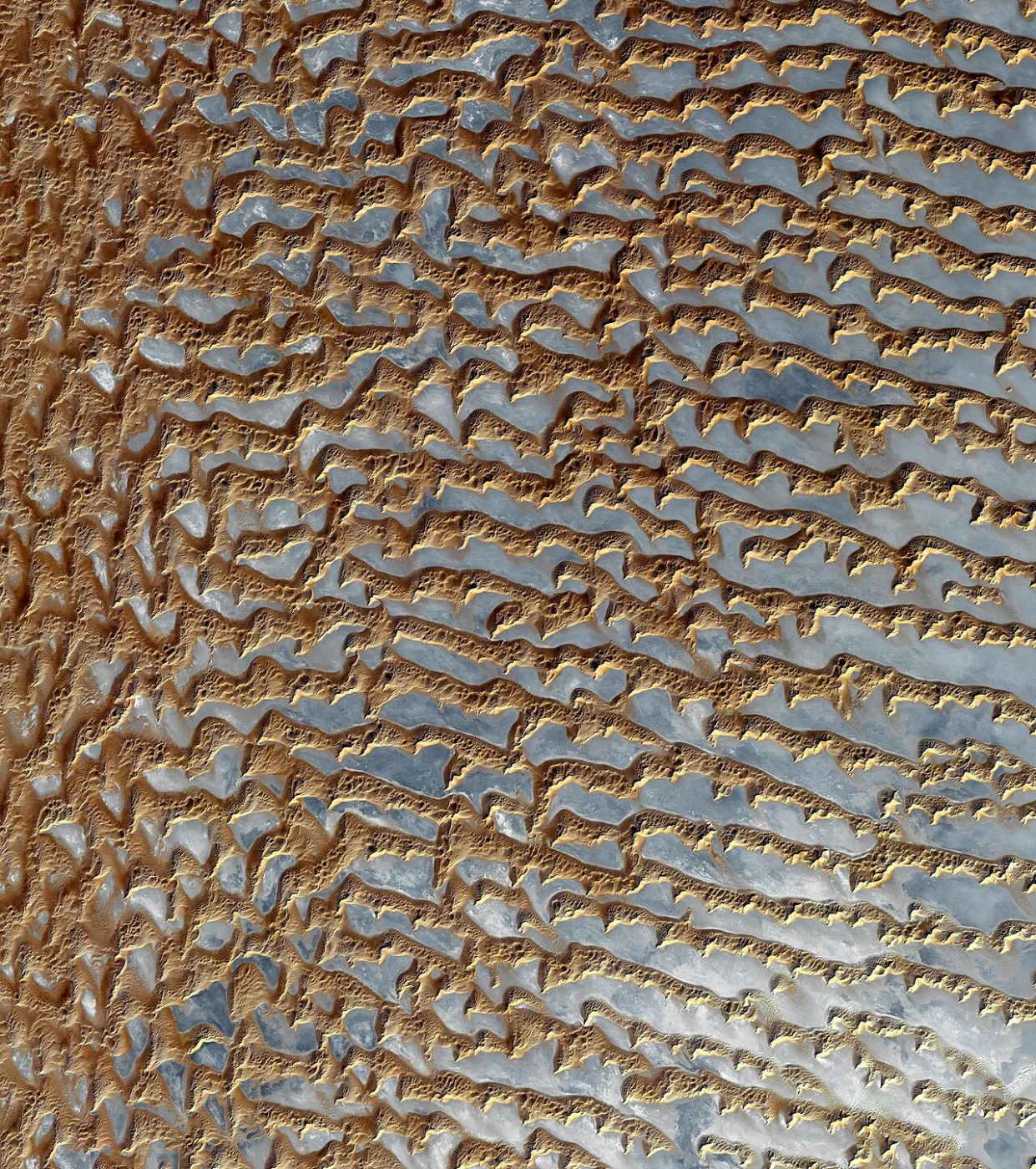
The dune landscape changes across the basin. A 2011 photograph taken from the International Space Station near the south-eastern margin in Oman shows reddish-brown linear dunes separated by salt flats, breaking up further north-east and east into isolated large star dunes. On the western edge, at the southern end of the Jabal Tuwayq escarpment, UNESCO records 35 longitudinal dunes up to about 200 kilometres long and 170 metres high, with low, rounded zibar dunes spread between them. UNESCO describes this western sector as part of the largest continuous sand sea on Earth.
WHAT IS THE CLIMATE OF THE RUB AL KHALI DESERT?
Britannica records summer heat of about 55°C in parts of the Arabian Desert, and average rainfall below 100 millimetres a year, with yearly totals anywhere from zero to 500 millimetres. Interior skies are usually clear, broken by intermittent winter rain, spring haze and dust storms. In the Rub' al Khali, occasional summer rains arrive on monsoon winds from the Indian Ocean, and winter rains may reach its northern part. The most arid part of the whole Arabian Desert appears to be the western margin of the Rub' al Khali, north of Wadi Al-Dawasir.
Wind is the other defining force. Two windy seasons, December to January and May to June, bring the shamal, which blows for 30 to 50 days at an average of about 48 kilometres an hour, and Britannica notes that each shamal storm carries millions of tons of sand into the Rub' al Khali. Strong south-east gales sometimes sweep the sands for several days at a time, and in the south-eastern sector winds blow from all directions. Rain that does fall is not entirely lost: dune sand can hold it to a depth of about one metre or more, which allows plants to grow on the flanks of dunes in the eastern Rub' al Khali, an area generally thought of as barren.
WHEN DID THE EMPTY QUARTER HAVE LAKES?
Exposed lake-bed sediments, scattered stone tools and fossils of hippopotamus, water buffalo and long-horned cattle show, in NASA's summary, that the Rub' al Khali once had a cooler and wetter climate and supported human settlement. In a 2009 review in Comptes Rendus Géoscience, Frank Preusser placed the most secure humid phase between about 10,000 and 5,500 years ago, ending somewhere between 6,000 and 5,000 years ago. At its peak, about 4.4 per cent of Arabia was covered by lakes. He described a savannah-like landscape with grazing herbivores and human occupation during that time.
Older lakes are harder to pin down. Radiocarbon dates had placed a Pleistocene lake phase at about 35,000 to 20,000 years ago, but Preusser noted that these ages may underestimate the true age of the deposits because of carbon contamination in the samples, and that the phase needs re-dating. Cave formations, or speleothems, elsewhere in Arabia point to further humid phases during earlier interglacials, many of which are likely missing from the lake record because later erosion removed the sediments.
A study by researchers led from the University of Geneva, published in Communications Earth & Environment in April 2025, identified a large former lake in the Rub' al Khali itself. Using satellite elevation data, the authors mapped a depression of about 1,100 square kilometres that filled with water fed mainly by Wadi ad Dawasir, carrying sediment from the Asir Mountains up to 1,000 kilometres away. At its highest level the lake was about 40 kilometres across, held about 20.7 billion cubic metres of water and was roughly 20 times the size of the Holocene lake at Mundafan. It eventually overflowed and cut a valley about 150 kilometres long. The authors date the humid period to between about 11,000 and 6,000 years ago, peaking from 9,500 to 7,200 years ago, and note that the lake has not yet been checked in the field.
FRANKINCENSE ROUTES AND THE BEDOUIN OF THE SANDS

On the southern edge of the desert, in the Dhofar region of Oman, the trade in frankincense ran past the desert's margin. UNESCO's Land of Frankincense site, inscribed in 2000, includes Wadi Dawkah, where the frankincense tree Boswellia sacra still grows in a wadi whose waters disappear into the desert, and the oasis of Shisr, or Wubar, a fortified outpost near the Rub' al Khali. UNESCO describes Shisr as an important station for water supply on routes from Nejd and the interior, along which resin from the coastal hinterland moved to ports such as Khor Rori, active from the fourth century BC to the fifth century AD.
Both of the 20th century crossings described below were made with Bedouin guides. The Pitt Rivers Museum at the University of Oxford, whose online archive documents Thesiger's journeys, names the groups he travelled among in the 1940s, including the Rashid, Bayt Kathir, Mahra, Harasis, Sa'ar and Bani Yas. Bertram Thomas's guide in 1930 was Shaikh Saleh bin Kalut al Rashidi al Kathiri. In 1946 Thesiger's route north from Salalah passed the well at Shisr, the old caravan station. His companions on the first crossing came from the Rashid and Bayt Kathir; on the second, from the Rashid, with two guides from the Sa'ar.
BERTRAM THOMAS'S CROSSING OF 1930 TO 1931
Bertram Thomas sailed from Muscat to Dhofar in early October 1930 on an Anglo-Persian Oil Company tanker, according to the Qatar Digital Library. Thomas and his guide, Shaikh Saleh bin Kalut, set off together from Salalah on 10 December 1930 and reached Doha, in Qatar, 59 days later, completing a crossing of the Rub' al Khali from south to north. Along the way he used a prismatic compass, a hydrometer and a sextant to compile a map of south-east Arabia.
Thomas also recorded the plants and animals he saw along the route and sent many specimens back to the Natural History Museum in London. After his return he presented a series of papers on his discoveries to the Royal Geographical Society, and the instrument readings taken on the march went into his map of south-east Arabia. In December 2015, an Anglo-Omani expedition that included the British explorer Mark Evans and a descendant of Shaikh Saleh bin Kalut set out to retrace the 1930 to 1931 journey for its 85th anniversary.
WILFRED THESIGER'S TWO CROSSINGS OF THE EMPTY QUARTER
Wilfred Thesiger made his first crossing while working as a researcher for the Middle East Anti Locust Unit. On 25 October 1946 he left Salalah with Rashid and Bayt Kathir Bedouin, crossed the Jabal Qara mountains, travelled via the wells of Ma' Shadid and Shisr and reached the oasis of Mughshin on the desert's southern edge. When the party leader, Sultan bin Ahmad, wanted to turn back at Ramlat al Ghafah, four men stayed with Thesiger: Muhammad al Auf, Salim bin Kabina, Mabkhaut bin Arbain and Musallim bin Tafl. They crossed the high dunes of 'Uruq ash Shaybah and reached the sands just south of Liwa Oasis in mid-December 1946, then returned through Oman to Salalah on 23 February 1947.
His second crossing, from 17 December 1947 to 14 March 1948, ran west of the first. Starting from the Manwakh well in Yemen, Thesiger travelled with the Rashid companions Salim bin Kabina, his brother Muhammad bin Kalut, Salim bin Ghabaisha and 'Amair bin 'Omar, and two Sa'ar guides, Salih and Sadr. They crossed the 'Uruq az Zayza and 'Uruq al Awarik dune fields, turned north and east to Jabrin Oasis and the Ad Dibin well, then crossed the Sabkhat Mutti and Al Dhafra to Liwa and north through the Baynunah sands to Abu Dhabi. The Pitt Rivers Museum quotes his tribute to his companions' "light-hearted gallantry".
WHAT ANIMALS LIVE IN THE RUB AL KHALI DESERT?

The Arabian oryx is the desert's best-known animal. Britannica records that it had nearly disappeared by 1960 and was later reintroduced after captive breeding, and that its main forage in the eastern Rub' al Khali is nasi, a sweet grass. Other wildlife listed by Britannica for the Arabian Desert includes gazelles, the fat-tailed dab lizard, monitor lizards, the sand cobra, sandgrouse, bustards, coursers, falcons, jerboas and the fennec fox. Desert plants are mostly drought-tolerant or salt-tolerant, and after spring rain long-buried seeds can germinate and bloom within hours.
The main refuge for these species is 'Uruq Bani Ma'arid, the World Heritage site on the western edge of the sand sea. UNESCO describes it as the last place where Arabian oryx were observed in the wild, and as a site where the species has since been reintroduced. The property covers 1.27 million hectares and holds about 19 per cent of the world's Arabian oryx, 25 per cent of Arabian sand gazelles and 2 per cent of Arabian mountain gazelles, along with five reptile species endemic to Arabia. Its 118 recorded plant species form the richest flora in the Rub' al Khali, with vegetated wadis that give animals food and shelter.
DESERTSCAPE AT THE SPA, MANDARIN ORIENTAL JUMEIRA, DUBAI

Silverfox Studios completed The Spa at Mandarin Oriental Jumeira, Dubai in 2019. The design is based on a concept called DesertScape, which is drawn from the curved, ridged forms of sand dunes, the landform that UNESCO records reaching 170 metres in height on the western edge of the Rub' al Khali. The spa has nine treatment rooms, and each has full-height windows that look out to the beach and the waters of the Gulf. In addition to the nine rooms, the spa includes a VIP suite and a separate hammam suite.
The vitality room contains a circular pool lined in dark mosaic. The walls around the pool are curved and finished in stratified marble, and the ceiling above it is rippled and lit from a concealed cove. Throughout the spa, the marble is laid so that its grain runs in a continuous line from one surface to the next. Seating takes the form of cocoon pods upholstered in linen. The principal materials named for these spaces are dark mosaic, stratified marble and linen, with cove lighting set into the rippled ceiling of the vitality room.
SOURCES
- Britannica Rubʿ al-Khali
- Britannica Arabian Desert: Climate, plant life and animal life
- NASA Earth Observatory Ar Rub' al Khali Sand Sea, Arabian Peninsula
- UNESCO World Heritage Centre ʿUruq Bani Maʿarid
- UNESCO World Heritage Centre Land of Frankincense
- Communications Earth & Environment (Zaki et al., 2025) Monsoonal imprint on late Quaternary landscapes of the Rub' al Khali Desert
- Comptes Rendus Géoscience (Preusser, 2009) Chronology of the impact of Quaternary climate change on continental environments in the Arabian Peninsula
- Qatar Digital Library Bertram Thomas and the exploration of the Arabian Peninsula, 1930 to 31
- Pitt Rivers Museum, University of Oxford Thesiger's Journeys in Arabia: First Empty Quarter Crossing 1946 to 7
- Pitt Rivers Museum, University of Oxford Thesiger's Journeys in Arabia: Second Empty Quarter Crossing 1947 to 8