
SALT, ROCK AND THE LOWEST SHORE ON EARTH

The Dead Sea is a landlocked salt lake in the Jordan Rift, and Britannica describes it as the lowest body of water on the surface of Earth. On the Dead Sea, Jordan holds the eastern shore, and the Jordan Tourism Board gives the lake's level as 427 metres below sea level and its water as some ten times saltier than seawater. The lake has no outlet. Water arrives mainly from the Jordan River and leaves only by evaporation, a balance that governs both its salinity and its level. On the Jordanian side are the Mujib Biosphere Reserve, the Dead Sea Panorama on the Zara cliffs and, nine kilometres north of the lake, the baptism site of Bethany Beyond the Jordan.
WHERE IS THE DEAD SEA IN JORDAN AND HOW LOW IS IT
The basin is a product of plate movement. NASA's Earth Observatory explains that Africa and Asia are pulling apart along the Jordan rift valley and that the land between them has been subsiding for millennia, with rivers, most notably the Jordan, draining into the depression. NASA's Jet Propulsion Laboratory names the structure the Dead Sea Rift and links it to the Arabian plate moving northward away from the African plate. According to Britannica, the Jordan River supplies nearly all of the lake's water, entering from the north. In Arabic the lake is Al-Baḥr al-Mayyit, the "Sea of Death", and in Hebrew Yam HaMelaḥ, the "Salt Sea", a name also used in English.
The figure for its level depends on the year it was measured. Britannica gives a standard surface level of about 400 metres below sea level for the mid-20th century. A 2005 NASA Earth Observatory feature, based on a Landsat 7 image taken on 7 August 1999, described the surface as nearly 400 metres below sea level and covering 1,035 square kilometres. A JPL image page from 2006 gave 418 metres. By the mid-2010s, Britannica records, the level stood at about 430 metres below sea level, more than 30 metres lower than the mid-century figure.
WHY IS THE DEAD SEA SO SALTY
The salt comes from a closed water budget. NASA's Earth Observatory states that evaporation is the only outlet for the lake's water, and that on a hot, dry summer day evaporation can lower the surface by two to three centimetres, leaving the remaining water saltier. Britannica puts annual evaporation at about 1,400 millimetres. The climate drives that loss: at Sedom, Britannica gives an average January temperature of 17°C, an August average of 34°C and a recorded maximum of 51°C. Rain is scarce: the Al-Lisan station averages about 65 millimetres a year.
The result is one of the most concentrated natural waters on Earth. Britannica describes two layers: an upper layer, to about 40 metres, with a salinity slightly below 300 parts per thousand, and a deeper layer at about 332 parts per thousand, roughly a third of the water's weight in dissolved salt. JPL gives about 300 parts per thousand, or nine times the salinity of the ocean. The chemistry differs from seawater: JPL gives the brine as approximately 53 per cent magnesium chloride, 37 per cent potassium chloride and 8 per cent sodium chloride. Britannica adds that the deepest water is saturated with sodium chloride, which settles to the bottom.
FLOATING, MUD AND MINERAL DEPOSITS
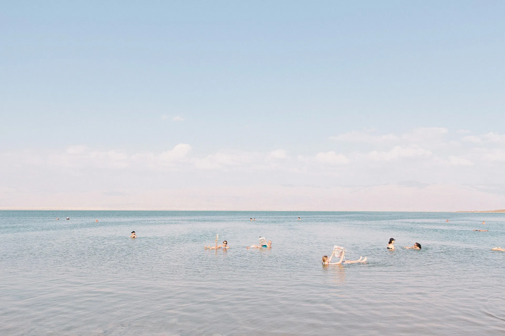
The same concentration explains the lake's best-known feature. According to Britannica, the saline water has a high density that keeps bathers buoyant, and the Jordan Tourism Board states that it is "quite literally impossible to sink". The shore also yields a dark mud, which the tourism board describes as "rich, black" and as used by visitors. The board lists the lake's minerals as chloride salts of magnesium, sodium, potassium and bromine, among others. It also names King Herod the Great and Cleopatra among the lake's visitors in ancient times.
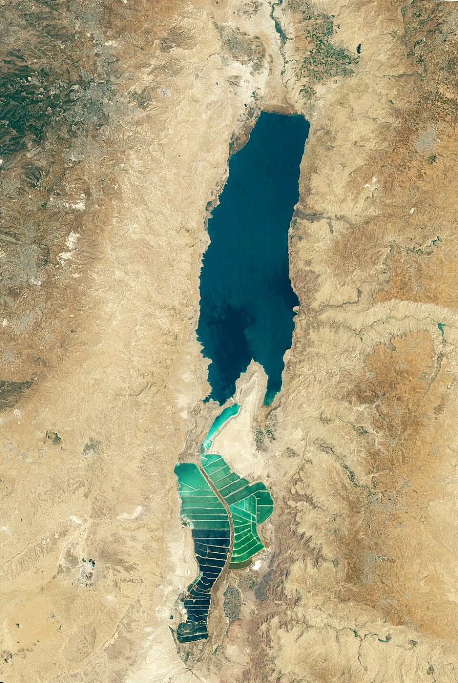
The minerals are also extracted commercially. JPL records that chemists in the early 20th century deduced that the sea was a natural deposit of potash and bromine. Its 2006 page put the combined output of Jordan and Israel at 3.8 million tons of potash, 200,000 tons of elemental bromine, 45,000 tons of caustic soda and 25,000 tons of magnesium metal, produced in salt evaporation pans that have essentially diked the entire southern end of the lake. In NASA's 1999 Landsat image, the southern part appears mostly dry apart from ponds used to extract potash, a potassium-based salt, and other salts, shown in pale blue alongside wetlands.
SALT SNOW AND SALT GIANTS ON THE LAKE FLOOR
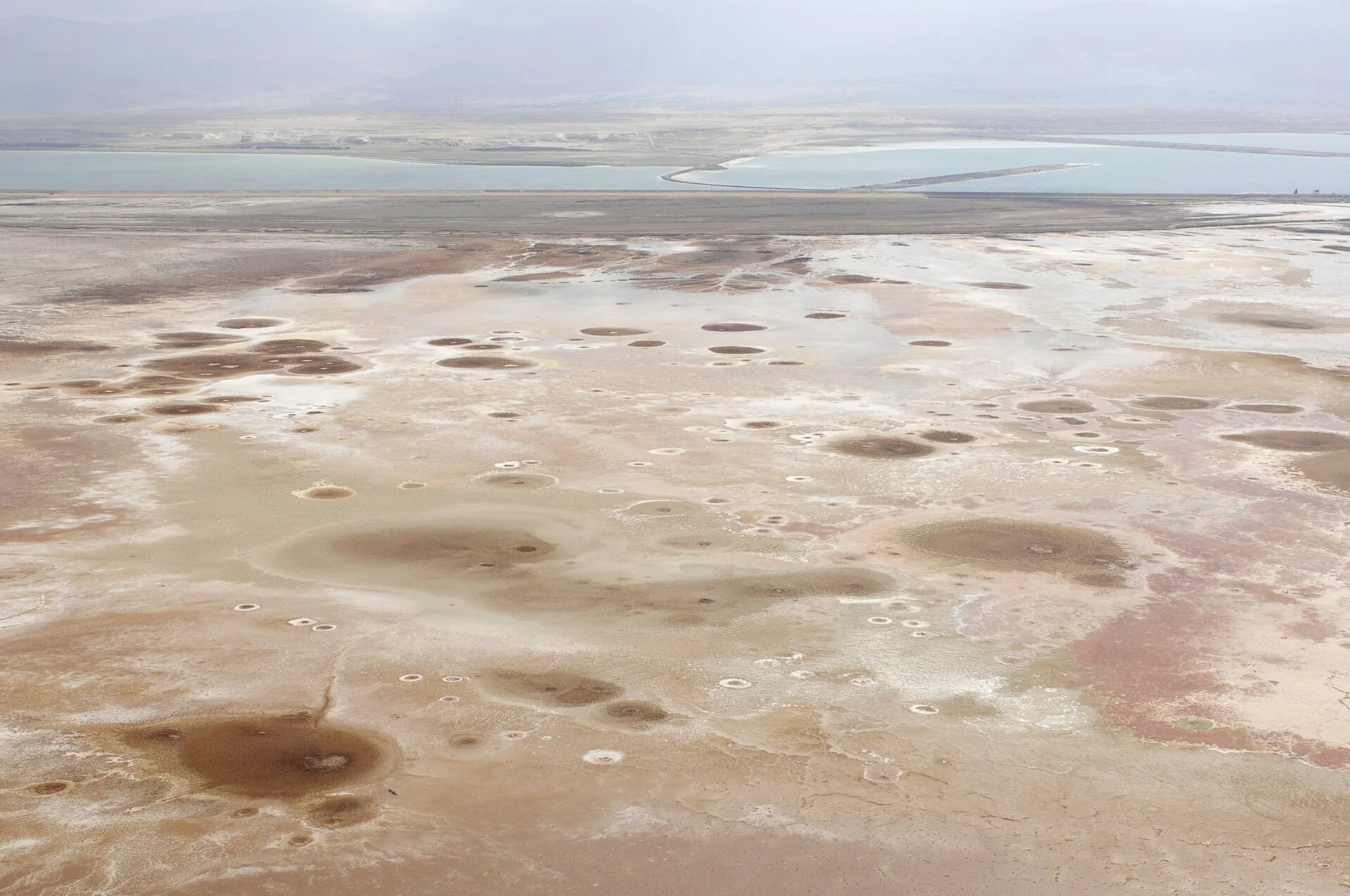
Not all the salt stays dissolved. A 2019 study in the journal Water Resources Research, by Raphael Ouillon and Eckart Meiburg of the University of California, Santa Barbara, with Nadav Lensky, Vladimir Lyakhovsky and Ali Arnon of the Geological Survey of Israel, examined halite crystals that form in the upper water and sink to the bed. The American Geophysical Union's release on the paper explains that scientists first noticed this "salt snow" in 1979. In summer, solar heat splits the lake into a warm upper layer over a colder lower one, and evaporation makes the upper layer saltier. Small disturbances from waves create "salt fingers" that carry salt downward, and the salt layer on the lakebed has grown about 10 centimetres thicker each year.
A 2025 review by Meiburg and Lensky in the Annual Review of Fluid Mechanics, reported by UC Santa Barbara, set the process against the geological record. Salt giants are deposits that can extend many kilometres horizontally and exceed one kilometre in thickness, and Meiburg describes the Dead Sea as the only place where the mechanism that forms them can be studied today. The Mediterranean holds such a buried salt crust from the Messinian Salinity Crisis, about 5.96 to 5.33 million years ago, when the Strait of Gibraltar closed and the sea dried substantially. On the Dead Sea floor, the review notes, salinity fluxes and sea-floor springs also contribute to salt domes and salt chimneys.
WHY IS THE DEAD SEA LEVEL FALLING
Britannica records that inflow from the Jordan River once averaged about 1.3 billion cubic metres a year and that diversions have reduced it to a small fraction of that figure. From the 1960s, the diversion of much of the river's flow and greater commercial use of the lake's water produced what Britannica calls a precipitous drop in the water level, and as of the mid-2010s the surface was still falling by about one metre a year. UC Santa Barbara's 2025 report gives the same rate of roughly one metre a year.
The retreat has changed the shape and behaviour of the lake. NASA's Earth Observatory notes that the Dead Sea has been split into two lobes: a northern basin that was historically deep and a southern one that was historically shallow and is now mostly dry. UC Santa Barbara reports that in the early 1980s the lake changed from meromictic, with layers that never mix, to holomictic, with water that mixes fully, and that it now stratifies for the eight warmer months of the year. As the level falls, the American Geophysical Union explains, new salt layers concentrate in the central part of the basin.
THE DEAD SEA, JORDAN SIDE: MUJIB, MA'IN AND THE PANORAMA
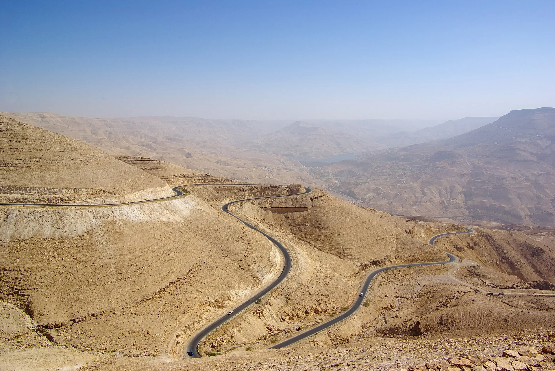
On the eastern shore, the Royal Society for the Conservation of Nature manages the Mujib Biosphere Reserve, established in 1985. It covers about 212 square kilometres and runs for about 24 kilometres beside the lake, from Wadi Zarqa Ma'in in the north to Wadi Shuqayq, taking its name from Wadi Mujib, which crosses its southern part. The society describes it as the lowest nature reserve on Earth, ranging from about 410 metres below sea level to 800 metres above. Mujib, Wadi al-Hidan and Zarqa Ma'in are its three main drainage basins and an important source of water for the Dead Sea. More than 300 plant species have been recorded there, along with the Nubian ibex.
Above the lake, the Dead Sea Panorama Complex sits on the edge of the cliffs of the Zara mountain range, where the Jordan Tourism Board recommends it for its sunsets. The board places the shore road at about 350 metres below sea level, describes a 3.5 kilometre promenade along the water, and sets Wadi Mukheiris, with palm trees, cascades and freshwater crabs, in the middle of the hotel area. Inland, at 264 metres below sea level, the Ma'in Hot Springs comprise 109 hot and cold springs fed by winter rain on the highland plains. The board states that underground lava fissures heat the water to as much as 63°C before it empties into the Zarqa River.
The Jordan Tourism Board also describes the Lowest Point on Earth Museum, a small museum displaying finds from Lot's Cave on the hill above, as well as Graeco-Roman clothing and hundreds of Greek inscriptions. The cave, the board notes, is believed to be where the Prophet Lot escaped after the story of Sodom and Gomorrah; it was later converted into a church, and its mosaic floor is still visible. In Ghor al-Safi, a crafts centre run with the Ghor Al Safi Women's Association for Social Development sells handicrafts made by 15 local women.
BETHANY BEYOND THE JORDAN: THE BAPTISM SITE NEAR THE DEAD SEA

UNESCO's World Heritage List records the Baptism Site "Bethany Beyond the Jordan" (Al-Maghtas) on the eastern bank of the River Jordan, nine kilometres north of the Dead Sea. The property has two parts: Tell Al-Kharrar, also known as Jabal Mar-Elias or Elijah's Hill, and the area of the churches of Saint John the Baptist near the river. Its Roman and Byzantine remains include churches and chapels, a monastery, caves used by hermits and pools in which baptisms were celebrated, with physical remains dated between the 4th and 15th centuries CE. UNESCO notes that the site is believed to be where Jesus of Nazareth was baptised by John the Baptist, and that it is also associated with the life and ascension of Elijah and with Elisha.
The site was inscribed on the World Heritage List in 2015 under criteria (iii) and (vi), and National Geographic notes that the Bible identifies the location as Bethany Beyond the Jordan in John 1:28. The magazine describes worn marble steps leading down to a natural spring, first-century sandstone walls bearing crosses etched by early pilgrims, Byzantine ruins with mosaic floors and hermit caves now open to visitors. The magazine adds that the Jordan River can flood in winter, particularly in December and January. UNESCO records that Christians continue to perform baptism rituals at the site.
W AMMAN: PETRA'S CANYONS IN JORDAN'S CAPITAL

National Geographic puts the drive from Amman to the baptism site at about 45 minutes on the Dead Sea Highway, turning north at Sweimeh, and the Jordan Tourism Board's Dead Sea Ultra Marathon covers the 42 kilometres from Amman to the Dead Sea every April, ending at a lake the board places 427 metres below sea level. In the capital, W Amman opened in April 2018 as W's first hotel in Jordan. Silverfox Studios designed the full interiors of the 40-storey hotel.
The interiors draw on two Jordanian landscapes: the rose rock and canyon of Petra and its Siq, and Amman's hillside city of limestone. Guests arrive through a "Canyon Walk" that recalls the Siq with angled planes and lines of light. Beyond the arrival, movement through the hotel follows forms shaped like canyons and shards, a sequence organised as a "Journey of Discoveries" that carries the canyon theme of the entrance through the circulation of the building. Shards also appear on the exterior, where the 40-storey tower has a faceted, shard-like façade.
SOURCES
- Britannica Dead Sea
- Britannica Dead Sea: Climate and hydrology
- NASA Earth Observatory Dead Sea
- NASA Jet Propulsion Laboratory The Dead Sea
- American Geophysical Union New study solves mystery of salt buildup on bottom of Dead Sea
- University of California, Santa Barbara Dead Sea's salt giants offer rare glimpse into Earth's geological past
- Jordan Tourism Board The Dead Sea
- Royal Society for the Conservation of Nature Mujib Biosphere Reserve
- UNESCO World Heritage Centre Baptism Site "Bethany Beyond the Jordan" (Al-Maghtas)
- National Geographic Bethany Beyond the Jordan, Jordan